Why a Hilltop Feels Like a Landmark
Learn why a hilltop feels like a landmark by noticing how its shape, paths, and nearby features organize a familiar view and guide your description.
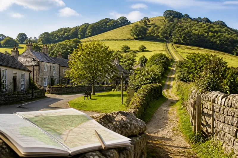
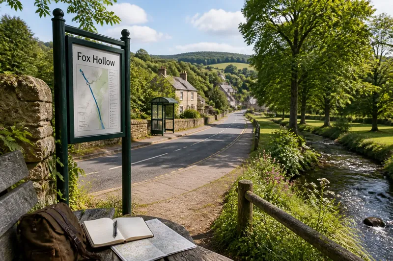
At the village bus stop, a low ridge rises behind the rooftops, and the footpath sign points toward a gap in its tree line. You may not know the ridge’s name, but you can use that gap to place the stop in the surrounding landscape. A hilltop feels like a landmark when its shape or position helps people connect one place to another.
That role is not limited to a dramatic summit. A gentle rise can become a useful reference because a road curves around it, a path crosses its shoulder, or a church sits near its crest. To describe the hill, look beyond its silhouette: notice how people encounter it, what routes meet it, and which nearby places it helps distinguish.
Routes give a hilltop its everyday meaning
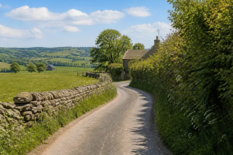
A rise can serve as a practical point of reference without offering a grand view. A lane may split at its foot; a trail may climb to a saddle between two summits; a row of houses may follow the contour of its lower slope. Those relationships tell a reader how the hill fits into ordinary movement through the area.
Pay attention to the route’s shape and the hill’s position along it. Does the road bend around the base, cross a shoulder, or disappear behind the crest? Is the path toward the summit a direct climb, or does it follow a gentler slope? Use the visible connection rather than assigning the hill a broader role the scene cannot establish.
For example, imagine a fictional village where a paved lane reaches a fork beside a grassy rise. One branch follows the base toward a school, while a gravel footpath climbs toward a gap between two wooded crowns. Describing those connections gives a reader a way to picture how the rise relates to the village, without claiming that everyone uses it as a navigational marker.
Names can preserve a local distinction
A hill may have a formal map name, a neighborhood nickname, or no commonly used name at all. If you encounter a local name, distinguish what you know from what you can see. A sign, map, or conversation may establish the name in use; the hill’s shape alone cannot tell you why that name was chosen.
Names can also separate one rise from another. “The hill by the mill” may identify a place through a nearby landmark, while a map label may refer to a longer ridge rather than its most visible crest. If the distinction matters, check the wording on a local map or sign and describe the exact feature it appears to name.
When a name’s origin is uncertain, say so plainly or leave the origin out. A place name can invite a story, but resemblance or sound is not enough to establish its history. Keeping the name and the visible landscape distinct lets the reader enjoy both without confusing one for evidence of the other.
Land use shows how the slopes meet the settlement
Fields, gardens, woodland, and buildings can reveal where a hill’s slopes begin to matter to nearby life. A pasture may run up to a tree-lined crest; houses may cluster on the lower ground; a footpath may keep to the edge of a field rather than crossing it. These patterns help describe the hill as part of a lived-in place, not just a shape against the sky.
Look for transitions. Notice where a paved street gives way to a track, where a hedge follows the contour, or where tree cover begins. A hill that appears continuous from a distance may have a patchwork of uses up close. Describe the transitions you can see, but avoid inferring ownership, custom, or history from a boundary alone.
Say you are writing about an imagined rise above a row of cottages. From the bus stop, you can see gardens end at a hedgerow, a narrow track climb beside the hedge, and woodland begin near the crest. A description of that sequence helps a reader understand how the settlement gives way to the slope, while leaving the land’s ownership and past unstated.
Which hilltop clues help explain a place?
How can a hill help orient someone along a route?
Describe a visible connection, such as a road curving around the base or a path climbing toward a gap in the ridge. Naming where the route meets the hill is more useful than saying it is a landmark everywhere.
What should you check before using a local hill name?
Compare the name on a map or sign with the feature you mean, especially if the label could refer to a longer ridge or nearby summit. If the source or meaning is unclear, use the name without claiming an origin.
How do nearby buildings affect the way a hill is recognized?
A church, water tower, or line of cottages may help identify a particular view, but describe its position separately from the landform. That makes clear whether the hill, the building, or their combination is doing the visual work.
Can a hilltop matter even if it is hidden from some angles?
Yes: it may organize a route or a neighborhood view from a particular opening. Name the approach or viewpoint where it appears, and note what blocks it elsewhere if that contrast matters.
Use a short field check to make the description specific
A few deliberate observations can keep a description grounded and useful. For each point, make the decision that follows from what you see:
- Check the route: If a road or path meets the hill at a clear bend, fork, or crossing, describe that connection; otherwise, focus on the nearest route that is actually visible.
- Check the ridge shape: If the crest has a distinct gap, shoulder, or pair of rises, name that feature; otherwise, describe its broader curve without inventing a sharper outline.
- Check the name source: If a map or sign identifies the same landform, use that name; otherwise, call it a hill or ridge and leave the naming claim out.
- Check what meets the slope: If fields, gardens, or woodland form a visible boundary, describe where they change; otherwise, avoid suggesting a land-use pattern you cannot see.
- Check the buildings: If a structure sits on or near the crest, state its position separately; otherwise, describe the hill without adding a built marker.
- Check the viewpoint: If the hill appears only from a particular road or opening, name that viewpoint; otherwise, describe the wider visibility your position supports.
Here is a fully invented example with hypothetical details. Imagine a writer standing at a fictional library entrance, where a map labels a wooded rise as Cedar Hill. The writer first follows a visible footpath across a small green and sees it turn uphill beside a hedge. Next, the writer checks the map label and finds it applies to the same rise; the name can be used, but its origin remains unknown. From the entrance, the crest is hidden by nearby roofs, so the writer notes that the path reveals it after the hedge ends rather than claiming the hill dominates the library view. The resulting description can identify Cedar Hill by its name, the path’s turn, and the point where its crest becomes visible; the tradeoff is that it describes this approach, not every view of the hill.
Connect the hill to a place people can recognize
A useful description does not need to make a small rise sound monumental. It can show how a route bends beside it, where a local name appears, or how gardens give way to woodland on its slope. Those details make the hill specific to its setting.
When you write about why a hilltop feels like a landmark, let the connection do the explaining: identify the route, boundary, building, or place name that helps a reader locate it. A hill may be memorable from one approach and ordinary from another. Naming that limit gives the reader a more accurate sense of the landscape—and a clearer way to find the hill within it.